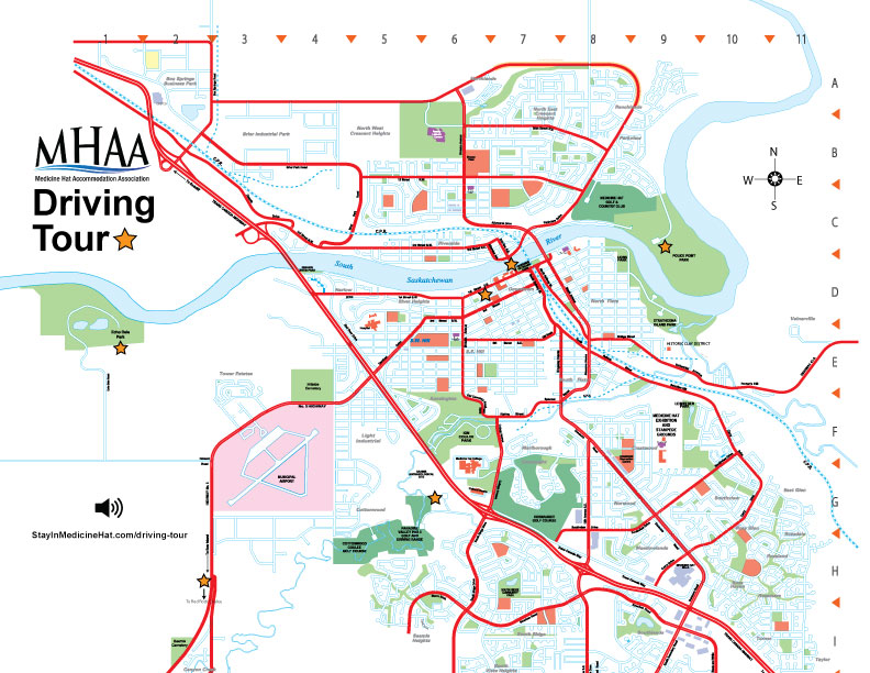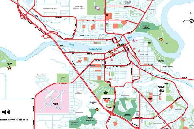
Medicine Hat Landmark Driving Tour
We have put together our Top 6 Medicine Hat Landmarks for you to enjoy from the comfort of your vehicle! This way you can see the Hat no matter what the weather!
We've included the GPS coordinates (or click for the Google map directions) and a brief audio description for each stop on the tour. Click the Learn More button has even more great details about these Medicine Hat landmarks. There's also a printable map at the bottom of the page if you want to find them the traditional way!
Don't forget to share your pictures with us of your favourite spot! @staymedicinehat
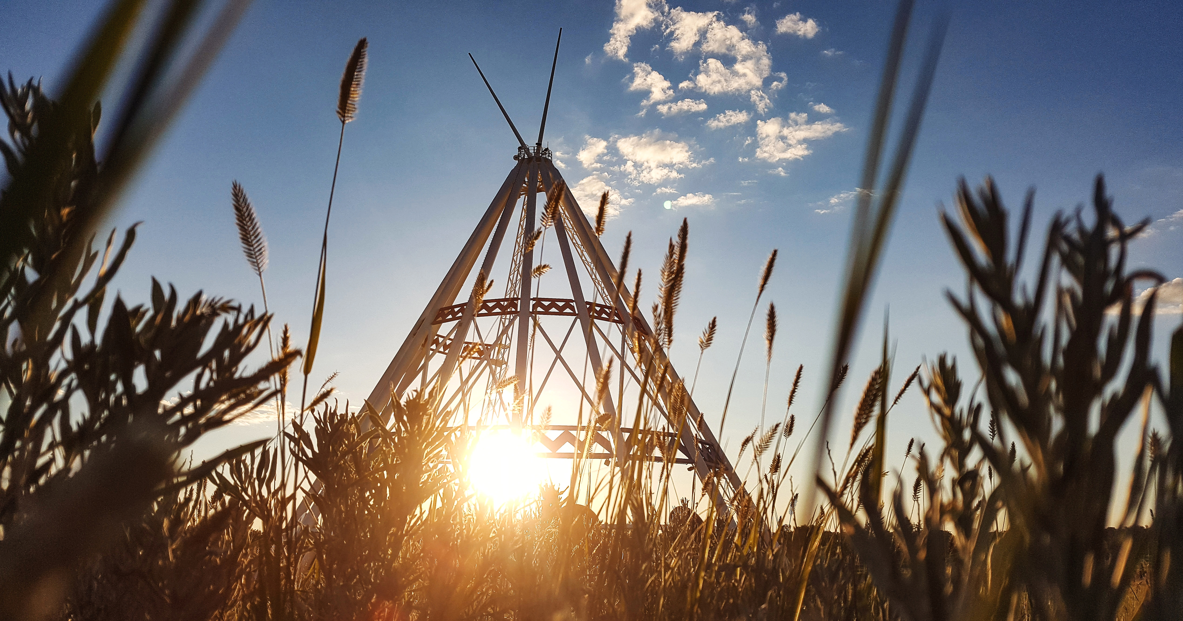
World's Largest TeepeeOriginally constructed for the Calgary 1988 Winter Olympics, the Saamis Tepee is a tribute to Canada’s native heritage.
|
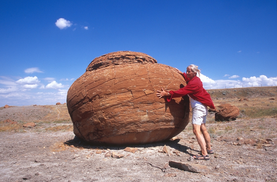
Red Rock CouleeLarge red spherical sandstone concretions that have eroded out of the softer bedrock, the best example of spheroid rock formations in Alberta.
|
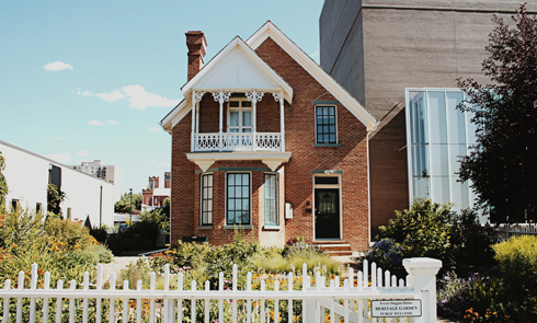
Ewart Duggan HouseAcknowledged as the oldest brick residence in Alberta still on its original foundation built with locally-produced bricks. |
Police Point ParkNamed because it once was the location of a Northwest Mounted Police outpost, the park is now the place to view nature in Medicine Hat.
|
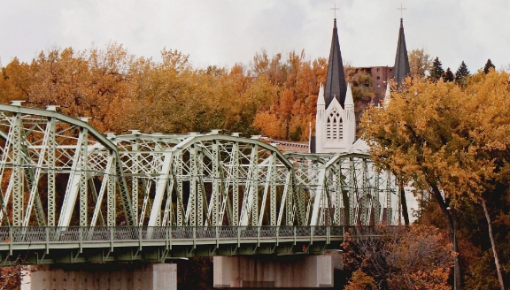
Finlay Bridge50°02'35.0"N 110°40'42.3"WFinlay Bridge is a traffic and footbridge crossing the South Saskatchewan River. Constructed of steel, concrete, and wood, this 900-foot span, officially opened on May 14, 1908.
|
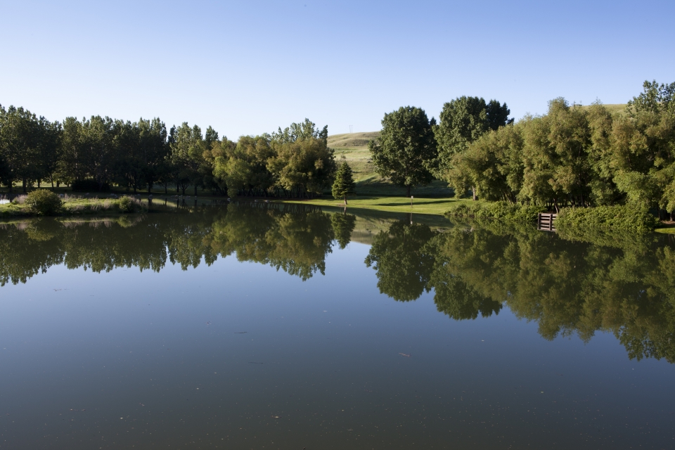
Echo Dale ParkFrom the historic farm site on the west side of the park to the day-use area on the far east side of the park and all the other areas in between, Echo Dale Regional Park is a local favourite. |
Click the coordinates under each landmark to follow the online map directions or click to download this printable map: